File:CIG Tlaquepaque RobertWillis 2018Apr.jpg
Original file (2,000 × 1,126 pixels, file size: 892 KB, MIME type: image/jpeg)
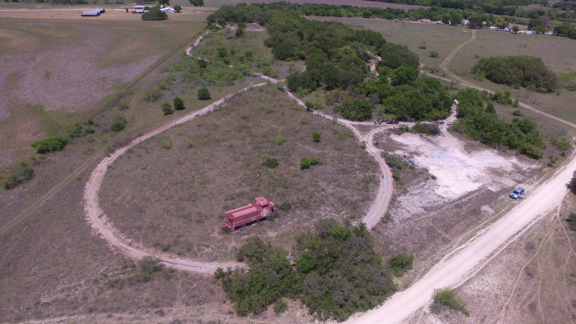
The big loop on the west end of the Comanche & Indian Gap RR. The area covered by trees next to the caboose is Tlaquepaque. Mexican hat is to the right, just to the right of the wye. The HEWT starts on the left side of the wye. Curving to the left from Tlaquepaque you reach summit, then straighten into Anasazi, then continue to cross the HEWT and on to Gotebo. After crossing the CIG, the HEWT moves to the left and then up into West Yard and Springerville. You can just make out Indian Gap and the Pickard homestead in the upper right of the photo. Photo by Robert Willis, April 2018.
File history
Click on a date/time to view the file as it appeared at that time.
| Date/Time | Thumbnail | Dimensions | User | Comment | |
|---|---|---|---|---|---|
| current | 15:01, 14 May 2018 | | 2,000 × 1,126 (892 KB) | Dnevil (talk | contribs) | The big loop on the west end of the Comanche & Indian Gap RR. The area covered by trees next to the caboose is Tlaquepaque. Mexican hat is to the right, just to the right of the wye. The HEWT starts on the left side of the wye. Curving to the left... |
You cannot overwrite this file.
File usage
The following page uses this file: